Up the Northern California Coast
UP THE NORTHERN CALIFORNIA COAST
ADRIAN ABEL
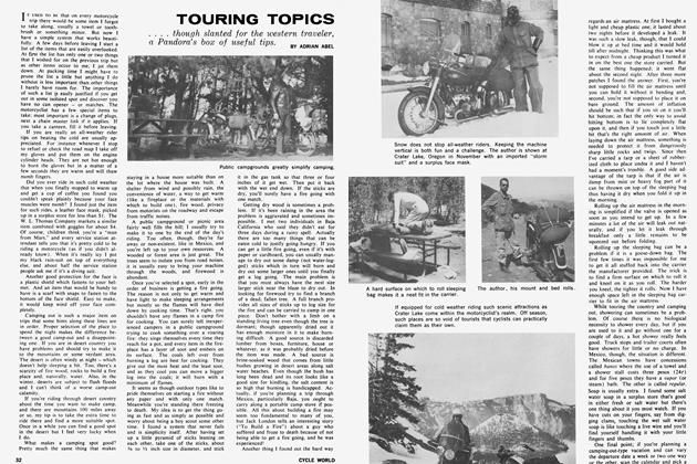
HEADING north from Santa Barbara on U.S. 101 in California, I tightened down my steering damper a few notches as George Engle on his R/69 and I on my KS 601 set our thottles for about 65 mph. Both machines were laden with camping gear and wet weather equipment in anticipation of the climate ahead. Our destination . . . Jedediah Smith Redwoods State Park near the Oregon border.
So often have we both made the trip up the more scenic route, State 1, to Monterey that we decided in favor of the faster U. S. 101 as far as Salinas; then over to the coast route, following it as far north as possible. Our first stop was Monterey.
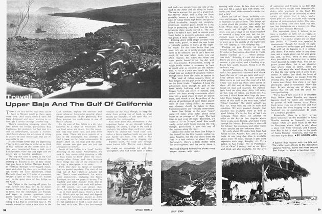
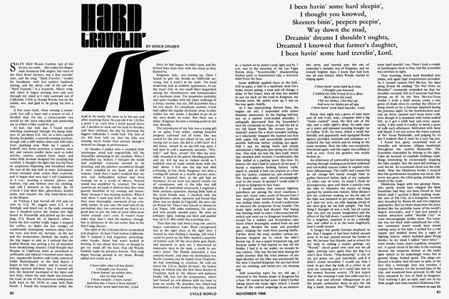
One of the prettiest spots along the California coast, Monterey is nestled in the south end of Monterey Bay. Often the weather is foggy, but while we tarried here it was blessed with clear enough weather to enjoy the scenic beauty which makes it famous. The noted author Robert Louis Stevenson proclaimed this area the most beautiful meeting of land and water he had ever seen and while the weather is clear enough to enjoy it, his words are seldom disputed.
The colored markings on the streets of Monterey indicate a tourist route taking in many of the historical attractions in the city. Among them are the old custom house, California’s first theatre and the landing site of Padre Junipero Serra, early pioneer and missionary who established the famous California missions.
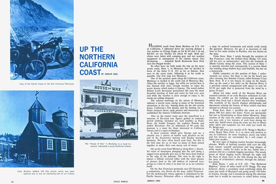
Also on the tourist route near the waterfront is a museum of life-sized wax figures garbed in authentic period clothing, included are such notables as Padre Serra, the bandit Vasquez, the explorer Portóla and author Stevenson. For an admission of 90 cents this museum is a must for those interested in California history and it is open on Sundays.
A local curiosity which gave George and me a chuckle was a chorus of harbor seals perched on the end of the breakwater making with Sunday morning harmony. We have often heard seals bark, but this is the first time for us to hear so many of them joined together to make their own merry sort of music.
On up the coast from Monterey along State 1, beautiful vistas of mountains plunging into the surf along a ragged coast gradually give way to flat mesa land formed to the edge of the palisade. The view to the right is always a hillside covered either with the short grasses of pasture land or the tall timbers of redwood trees giving us a hint of what is in store for us as we continue north.
On the San Francisco peninsula near El Granada is a community, not shown on the map, called Princeton. For the motorcyclist whose appetite is stimulated by the Pacific breezes, Princeton offers a refreshing spot for a stop; its seafood restaurants and stands easily satisfy the gourmet. However, for gas it is necessary to ride four or five miles further to Pacifica, also not shown on the map.
From there, State 1 winds through the outskirts of San Francisco, onto the Golden Gate Bridge (25 cents toll for cars or motorcycles) and into the lowlands of Marin County along the coast. This section of State 1 is sparsely traveled and consequently is a narrow black top winding along shallow bays and foothills, but fun on a motorcycle.
Public campsites on this portion of State 1 unfortunately are scarce, but there is one on the beach just after crossing into Sonoma County called Sonoma Coast State Park. If it is too breezy to camp on the beach, then up the road a few miles on the Russian River is a privately owned campground with spaces to rent for $1.50 per night that is protected from the wind by a grove of trees.
About ten miles north of the Russian River are restored remains of an early Russian settlement in California. On exhibit are the buildings and grounds in which they lived and a church wherein they worshiped. The vestibule of the church displays photographs and documents relating the history of these settlers and their attempt to colonize our country.
From here, State 1 parallels the coast on a shelf about 500 feet above the water. Views are spectacular but not as breathtaking as those below Monterey. Some sections of the road are under construction and traffic can pass only a few minutes of each hour during the work day. Small towns along the route are five to fifteen miles apart and campsites are few until you reach the Ft. Bragg area.
In the tall pines just outside of Ft. Bragg is MacKerricher Beach State Park. It is as clean and modern as any in California. Its stone fireplaces, picnic top tables and hot showers are surrounded by a soft carpet of fallen pine needles.
By now signs of logging country become increasingly obvious. Whiffs of burning sawdust drift over the hills from remote sawmill operations and long plumes of white smoke, visible for miles in the sky, funnel into a sawdust kiln on a roadside logging operation. The steady groan of diesel logging trucks through the night and the buzz of chain saws in the hills during the day tell the story of civilization’s advance through the defenseless forest.
' State Route 1 ends at U.S. 101, “The Redwood Highway” about 45 miles north of Ft. Bragg. The map however, shows a secondary road continuing along the coast just north of Rockport and going nearly 100 miles to Eureka. George and I considered taking this alternate route but it would be necessary to refuel before trying it. Of the two service stations within ten miles of the beginning of this road, one was out of gas and the other had no electricity to pump it. So we decided to save that side trip for another time. Now we planned to make time along the Redwood Highway, perhaps even to our destination by nightfall.
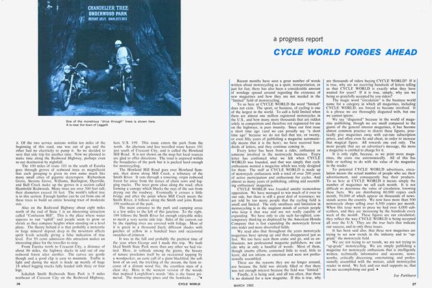
The 100 miles of route 101 to the south of Eureka goes through groves of redwood trees so magnificent that each grouping is given its own name much like many small cities of gigantic skyscrapers. Richardson Grove, Stevens Grove, Williams, Burlington, Dyerville, and Bull Creek make up the groves in a section called Humboldt Redwoods. Many trees are over 300 feet tall; their diameters exceed 16 feet. The world’s tallest tree is in this section. Enough lumber can be cut from one of these trees to build an entire housing tract of moderate size.
Also on the Redwood Highway about eight miles north of the end of State 1 is an interesting attraction called “Confusion Hill”. This is the place where water appears to run “uphill” and people seem to grow or shrink as they compare heights when standing on a level plane. The theory behind it is that probably a meteorite or large mineral deposit deep in the mountain affects spirit levels actually giving a false indication of true level. For 50 cents admission this attraction makes an interesting place for the traveller to stop.
From Eureka north to Crescent City, a distance of about 86 miles, the highway ducks in and out of one redwood forest after another. The curves are gentle though and a good clip is easy to maintain. Traffic is light and during the week is made up mainly of huge 18 wheel logging trucks fully loaded with three or four logs.
Jedediah Smith Redwoods State Park is 9 miles northeast of Crescent City on the Redwood Highway, here U.S. 199. This route enters the park from the north. An alternate and less travelled route leaves 101 just south of Crescent City, and is called the Howland Hill Road. It is not shown on the map but local sources are glad to offer directions. The road is unpaved within the boundaries of the park but it is packed hard enough for motorcycling.
The Howland Hill Road goes over Howland Summit, then down along Mill Creek, a tributary of the Smith River. It cuts through a towering, virgin redwood forest far away from the noises of chain saws and logging trycks. The trees grow close along the road, often forming a canopy which blocks the rays of the sun from drying out the roadway. Eventually it crosses a little bridge and after the point where Mill Creek meets the Smith River, it follows along the Smith and joins Route 199 northeast of the park.
The main entrance to the park and camping areas is a few miles to the left of this junction. To the right, 199 follows the Smith River for enough enjoyable miles to merit a very scenic side trip. Sides of the canyon cut by the rippling river are covered with foilgge. Most of it is green in a thousand finely different shades with patches of yellow in a hundred hues and occasional swatches of crimson.
It was in the fall and probably the prettiest time of the year when George and I made this trip. We both liked Smith State Park more than any other we had visited. Here, in solitude among the giants, the beauty of nature proclaims itself by an occasional tapping by a woodpecker, an eerie call of a giant blackbird, the soft hoot of an owl, the trickling of the stream, the faint incense of a distant wood fire, the countless stars of a clear sky. Here is the western version of the woods that inspired Longfellow’s words “this is the forest primeval. The murmuring pines and the hemlocks . . .”•