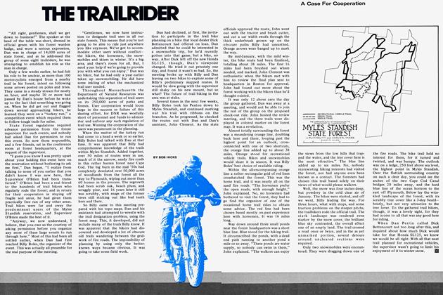
The Trailrider
THE TRAILRIDER
SOONER OR LATER the new guys around here with trail bikes start complaining about having no place to ride. They wore out Cherry Hill and the Manchester woods, and now they've used up all there is. We're only 20 miles from downtown Boston, and suburbia is swallowing up the farms of yesteryear, now growing crops of $50,000 homes.
This would be sad if it were true, but it isn’t. The new riders have used up the places they know, the places everyone else goes riding, the places they were told about. But they haven’t even started to find the good stuff hidden away among the housing tracts and shopping centers, the Interstate and the railway, the seashore and the Merrimack River industrial strip. When I tell people there’s over 100 miles of fun trail riding around here, in sight of the Boston skyline, they think I’m kidding them. Well, I’m not. Let’s go out for a day and I’ll open your eyes. There’s riding to be had anywhere if you look around enough.
About a half-mile from my place there’s a dead-end street in a small housing tract. From the far end, a vague open swath enters the adjacent woodlands. Its the trace of the buried gas line put through here 15 years ago. For a mile it is rideable over craggy, low hills, emerging at the now little-used old railroad to Topsfield. Down that between the rails at 35 mph, and you don’t feel the ties, just a small vibration. Then it’s a village and the street for a bit.
Soon we turn into an old driveway. Once it led to Dudley Rogers’ estate. He sold the place to developers, and they’ve put in a hundred houses; but they never did use the old driveway. It’s a nice winding dirt road for a half-mile into the housing area. Then across the Interstate construction the roughest way. Each time it’s different as work progresses. Eventually we’ll have to use the overpass.
Below the hill topped by the Victorian-era State Hospital for the Insane is a stretch of abandoned railway bed, which now has some small utility poles running along it. It’s fast going but we have to keep an eye out for wandering inmates allowed to roam the grounds for exercise. A bit more street riding, then it’s into Richardson’s old gravel pits, now unused, back of the drive-in movie. There’s some good jumps, climbs, and fast TT-style turns here until we hit Rt. 1 14. Now it’s a mile of hard road. Obviously, around here your dirt bike has to be street licensed.
Off to the right a well-worn path leads alongside the edge of a field, disappearing over a hilltop. On the far side we pick up a power line, the rough meandering service road a succession of dips and climbs and abrupt turns, for nearly three miles. We pass behind a row of suburban homes, they don’t own the right of way, and the kids wave. Or, put bottles on the old plank bridge we have to use across a polluted brook.
When the powerline crosses the Ipswich River, we can’t, it’s too deep, but we can ride alongside the little-used railway spur into the old BB Chemical plant. From there a quick end run over a bridge and we’re back on that powerline, with more of the rocky rugged land we have in Essex County. A detour around an impassable bog passes alongside the back wall of a golf course. We can’t ride out there, of course, but later today we’ll have a chance at one. Past a pond lined with summer camps, economy models, and along a narrow winding trail back to the powerline and on until we hit a super swamp. Our idea of fun doesn’t include crossing 100 yards of swamp on a narrow catwalk, so we detour a mile over the road, and rejoin the powerline at Santa’s Lookout.
John Muzichuk owns this poorly patronized roadside amusement spot. He doesn’t mind our passing his back lots to get to the powerline, and then its another couple of miles to pavement. This time we hit a broad asphalt highway to nowhere. Uncle Sam built this 3-mile road into an ABM site, only to abandon the whole thing under public opposition. The road is closed now, but everyone rides on it, the pavement crowd that is. What a dragstrip.
We stay on the powerline, soon crossing a stream on a narrow plank bridge, then taking a turnoff down old North Liberty Street. Since the ABM job, this town road has been abandoned, and it’s fine rough dirt road now. The ABM site is a vast, barren gravel place, with big holes full of water. It’s a free-form swimming hole summers. There’s some entertaining sights to see here on a summer Sunday, but we’re riding on a gray day in early spring. On the far side of this man-made desolation is Boxford State Forest. We can ride there in spite of what some local horsemen try to tell us. The high point is Bald Hill. We can see Boston’s Prudential Tower from here, and the ocean in Salem, and Gloucester’s rocky headlands 20 miles to the northeast. Near the foot of the hill alongside the old woods road leading out is a walled-in graveyard, three tombstones identify John Parsons, “A Soldier of the Revolution.” When I told the chairman of the Boxford Historical Society about this, he was surprised. He had walked near Bald Hill and never found it.
We emerge in Richardson’s summer pastures. When the grass greens up he’ll close the gates, but now we can go through out to the roadway again. My dad used to work for Hays Richardson in the ’30s, and his wife was once my second grade teacher, so no trouble getting his OK to ride his woods and pastures when they’re not in use. The snowmobilers never ask him, and he hates them. They break his fences down.
BOB HICKS
Take A Ride With A Creative Trail Seeker As He Finds Pay Dirt In The Shadow Of Megalopolis
An old railway bed parallels the road here. Horses use it, but mostly on Sundays. After two miles of flat moving beneath a long tunnel of overhanging brush, we pop out streetside behind a newly built house. Soon we’ll have to back off farther down the line when someone buys this place. Around a corner or two, and past a house with a bunch of bike-chasing dogs, and we’re onto Old Bradford Rd. still a town way, though it’s now deep in leaves and pine needles. Over two miles of lovely wooded open trail, with one big wheelie jump you can hit at 35 and fly a mile from.
The far end is on hard road, over a mile to the same old powerline we left a while ago, skipped some fenced-off areas, we did. Jim Nesbitt owns the land where the line climbs a steep hill, he’s a bikey, and up we go. Over two more steep hills, across two roads, and then the junction. We’ve been heading north, and now we swing eastward, toward the Atlantic, 15 miles away as the crow flies. There are fenced-off areas, so we have to adapt. Some street here, a farm road there, some woods road past another spot, in six miles or so we arrive in Georgetown. Time for coffee, we’re muddy and clumsy in our Barbour gear but our money is good, and the kid behind the counter has a Kawasaki.
Leaving Georgetown on the old railway bed to Newburyport, we turn off in Byfield after a fast three miles and take an old right-of-way into the Fish & Game lands. The state has about 4500 acres here they stock with game birds, and we can ride here on the service roads except in fall hunting season. Old Breakstone Rd. once ran through here, and we follow its rutted woody way until the sawgrass of the salt marsh is reached. Here we have to detour out onto the cinders of the railway bed again, but that’s fun too.
We skip over Interstate 95 when nobody’s coming, and head via an old woods road into another powerline over the Hunsley Hills. Two biggish hills and no service road, just the rough ground from the line construction a few years ago. Between the two hills a marsh has a rotting old corduroy log path, but we slip off always and spend some time heaving the bikes out. From here we pick up an overgrown old woods way through some really deep water, and out behind a mink farm. A few years ago a guy who scrambled owned the land at the end of this woods road. He bulldozed a practice track there, but neighbors, especially the mink man, raised a holler and he never was able to use it. We take a quick turn about it anyway. Across the street a gravel road leads to a dead end, but not for us. The old woods road goes into an unused millpond, and on out through a mile of woods to the street again, right through a suburban yard. The people in the house don’t own the right-of-way, though. Mr. Tenny does, and he says its OK to ride through. The homeowners are OK, anyway.
Then in a half mile we take the fire road into the western part of Willowdale State Forest, 3000 acres of woods that the Commonwealth of Massachusetts owns. One ranger with two helpers looks after this sizable suburban forest. Parker Gifford, the ranger, thinks we’re OK, ever since the day long ago when we met him out on a lovely, fast fire road along the top of a glacial esker. He asked us if we liked the road, and we, of course, were quite enthused. Well, turns out he and his tiny crew had labored all one summer cutting that road along the top of two miles of meandering glacial drift, and we were the first users to ever tell him what a great ride it was.
From the far side it’s a short road hop to the main part of Willowdale, east of the old Newburyport Pike. Here we still can get lost, there’s something like 20 miles of woods roads through this woodland. Some horses use it, and lots of snowmobiles. But the wildlife has gone, as suburbia completely surrounds the area, and dogs have driven off the deer and killed the smaller game. Next to the forest is Bradley Palmer Park, where we can’t go. There’s a 3-mile steeplechase course for horses in Bradley Palmer and most of the local horse gentry stay over there. We pick a more-or-less through route from the multitude of choices at each junction of woods road in Willowdale, emerging where some people are running an illegal slaughterhouse. They periodically get run in by state inspectors, but the hog killing goes on, and the stink is pretty awful. Out from here to hard road and across the way is a big housing development, Rambling Acres. Way down at the far end is a dirt road leading off from a dead-end street. Over the rise is that dream of any dirt rider, a real golf course to ride on.
Out on U.S. Rt. 1 nearby, a tottering, weatherbeaten old sign announces the Ipswich Country Club, with a golf course designed by famed golfing architect Robert Trent Jones. Three years ago they went broke, with five fairways finished, no greens in, and a dozen semi-finished fairways bulldozed from the scrub woods. A well-worn trail marks the bikeways over this vast, abandoned playground. Just who owns it now is unclear. The original entrance has been bulldozed shut, but there’s a dozen ways in from the adjacent woods. A tour around here covers some five miles before we emerge near Ipswich.
Now we face about five miles of street riding as we head east into Essex and toward the really rocky Cape Ann country around Gloucester. Large estates cover the flat land around Ipswich, the Appleton Farm of over 1000 acres was deeded to the Appleton family by King George in the early 1600s, and they still own it. They are horse people, and we don’t get to ride their miles of lovely winding lanes. Finally we reach Essex, and the gateway to some of the rockiest, roughest riding around. Cape Ann is solid rock, and populated mostly along the seashore. The inland areas are empty, it’s too hard to build on such craggy rock. The riding is great.
But, it’s lunch time, actually it’s 2 in the afternoon, we’ve been riding since 9 a.m., and covered 80 miles so far. As we stop off at the “Eat in the Ruff” clam and french fry place on the Essex Causeway for something to eat, we realize that we’ve still got maybe 30 miles to go before dark, here where there’s just no place to go trail riding. Trails, it seems, are where you find them. [Ö]